Your Window to 3,222 Possibilities
Relocating isn’t just about finding a house—it’s about finding a community where your family can thrive. The full-screen interactive map puts the entire United States at your fingertips, letting you explore every county from coast to coast.
This is where your relocation journey comes to life. Pan across the country. Zoom into regions that catch your eye. Discover counties you never knew existed. Each one of those 3,222 shapes on the map represents a potential new hometown, complete with its own character, climate, and community.
Search the Way You Think
Forget typing zip codes into tiny search boxes. Our map understands what you’re actually looking for.
Want to find somewhere with mild winters and good schools? Just ask: “Where should I move if I want four seasons but hate the cold?” The map will highlight counties that match your preferences, ranked by how well they fit what you’re describing.
This isn’t keyword matching—it’s semantic understanding. The search interprets phrases like “affordable coastal living” or “mountain communities near military bases” and surfaces relevant results. It’s like having a conversation with someone who actually knows every corner of America.
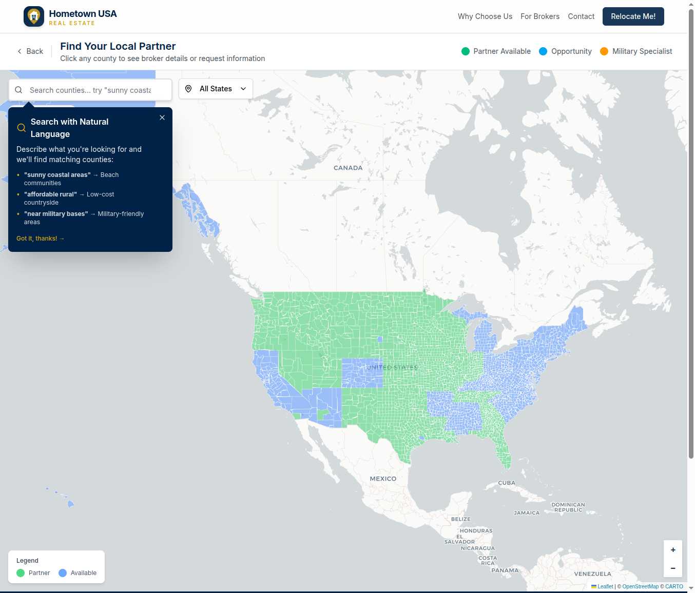
A Color-Coded Compass
Every county on the map tells a story through its color:
Green counties are ready for you. These areas have vetted partner brokerages already in place—local experts who know the neighborhoods, understand the market, and are ready to guide you through your relocation. Click on any green county, and you’ll see exactly who’s waiting to help.
Blue counties represent opportunity. These areas are open for partnership, meaning we’re actively looking for quality brokerages to serve families relocating there. If you’re a real estate professional, blue counties are your chance to claim exclusive territory.
As you hover over the map, counties light up with hover effects, inviting you to explore. Click any county to see detailed information about the area and its available resources.
Drill Down to What Matters
Found a county that interests you? Click it to open a popup with everything you need to know:
For counties with partner brokerages, you’ll see the brokerage name, their specializations, and a direct path to connect. A single click on “Request More Info” opens a streamlined form where you can share your contact details and timeline.
For available counties, you’ll see a description of the area along with an invitation for real estate professionals to apply for partnership. Every county gets attention—we’re building a network that eventually covers them all.
Filter Your Search
Looking for counties in a specific state? The state filter dropdown lets you narrow your view instantly. Combined with natural language search, you can get remarkably specific: “rural Texas counties with low property taxes” or “Oregon coast communities with good internet.”
The map remembers your preferences as you explore, so you can refine your search iteratively. Start broad, then narrow down as you discover what matters most to you.
Built for Exploration
Some people know exactly where they’re headed. Others are open to discovery. This map serves both.
If you have orders to a specific base, search for nearby counties and compare your options. If you’re choosing your own adventure, zoom out and let curiosity guide you. Either way, the map adapts to how you want to explore.
The counties aren’t just shapes—they’re clickable, hoverable, and full of information. Each boundary comes from official US Census Bureau data, accurately representing the 3,222 counties and county-equivalents that make up the United States.
From Map to Connection
The journey from “I wonder what’s in that county” to “I just found my family’s new hometown expert” can happen in minutes:
- Explore the map using pan, zoom, and search
- Discover counties that match your criteria
- Click on a county to see details
- Connect with the local partner brokerage
- Submit a simple inquiry form
No complicated account creation required. No pressure. Just a straightforward path from curiosity to connection.
The map is waiting. Where will you start?